I have traveled a few areas in Singapore. Woodlands Water Front Loop is one that I do not favor. You will know the reason after reading through the post.
The loop starts right next to Republic Poly. The entrance is on the right of the picture.
This is a relative small, narrow and short park. A few areas are currently closed for repairs. Took a few pictures of plants and flowers along the way.
Sakura Buffet Restaurant is actually situated in the park but the entrance is on Riverside Rd.
The path seems to end behind the restaurant. You need to walk around the structure below to continue on the path.
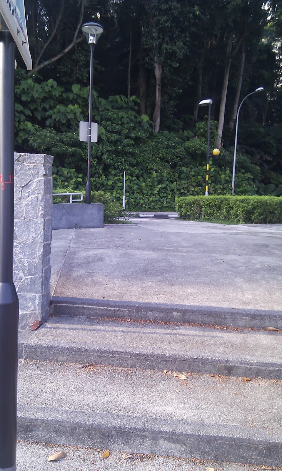
The north entrance to the park is actually a car park.
After the car park, Admiralty West PC leads you right to the Water Front. The sad part is that you have to cross the road at two points. The two points are perfectly normal. One have traffic light and the other is a zebra crossing. However, the motorcyclists coming in from Malaysia are not that friendly. Perhaps due to their rush to get to work, they ignore the traffic rules. I find them moving towards me despite I am already on the crossing. Some even speed pass right in front of me.
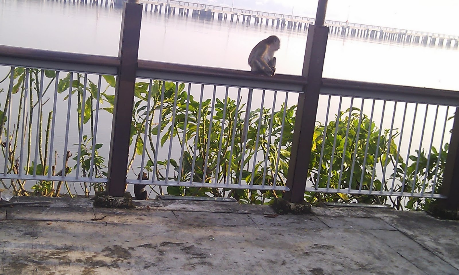
Please be aware that there are monkeys in the park. If you are careless, you might be chasing your belongings after them.
The water front pier is just in the back ground of the picture above. A close look is as below.
There is a eatery at the turning point. The last time I passed by at around 9am, it was still closed.
You can catch a view of our neighbor country here.
At this point, there is another crossing where you cross path with motorcyclists rushing to work.
Before you cross the road, turn back a bit and you will notice a cement book telling you about the history. Sorry, you can't turn the pages.
You will be on Marsiling PC once you cross the road.
It is a narrow up hill path. Near the road crossing point, the path is less than a meter wide. If you cycle, please be careful.
The PC leads you right to Woodlands Centre Rd. You need to take the spiral slope or the stair case to reach the road. The picture show the over head crossing at level point.
Walking along the road you will come across a junction where you need to do a "L" crossing. It is not a pleasant crossing as there are three pedestrian crossing where you need to press a button in order to cross. The amount of waiting for the light is frustrating. However, I can't blame LTA. This road is a very busy road.
Actually one elderly person on bicycle was trying to cross at the junction between Admiralty Rd and Woodlands Central Rd while the Red Man Light is on. He stopped near the road island then quickly cross it as the traffic is super heavy in the morning rush hour. I guess he is also in the rush too.
Woodlands Gardens is on the right hand side once you cross the "L" crossing. As the PCN does not go into the park, I just pass it by.
Further down the PC, you need to cross the road and turn right.
You will be taking Woodlands St 13 PC. To the right is Woodlands East Park and to the left is the Woodlands Sports Complex. In between you need to cross the road to walk on the other side.
Please be real careful when crossing Woodlands St 11. There is no pedestrian crossing on the 4 lane road.
The sign board above is huge. However, there is not a single entrance to the park near here. Odd.
At the end of Woodlands St 13 PC, you will cross the Woodlands St 13 to the Woodlands Ave 5 PC. Again there is no pedestrian crossing here. Walk carefully.
Woodlands Ave 5 PC and Woodlands Ave 2 PC together make a half crescent around Causeway Point. There is only one park near Woodlands Ave 5 PC (N Hood PK). The loop ends at the end of Woodlands Ave 2 PC. One stretch of Woodlands Ave 2 PC is worthy mention. At around 5PM, Republic Poly students will swarm all over the PC. It is almost impossible to cycle on the PC especially if you are going along their direction towards Causeway Point. They will certainly not aware of your presence even when you ring your bell.
By now you would have noticed a few mentions about unpleasant encounters while cruising on the route. That is the reason why I would not rate the route as good. As a Woodland people, It is sad to have such nice route that gives an unpleasant taste after the walk.
More pictures are available here. https://picasaweb.google.com/106611639464075912591/WoodlandsWaterFrontLoop
MapOmeter route information is here http://sg.mapometer.com/walking/route_2851854.html
Wednesday, May 22, 2013
Friday, May 17, 2013
Out of Memory
For those with newer phones, the "phone memory" is at least 1GB. For those who still uses FROYO like me, the available memory is a meager 150MB. With around 20 apps installed, I always receive "out of memory" message.
I was scratching my head on how could I remove unnecessary apps. There are a few OEM installed apps which I can never remove. Thus as time goes, I end up with less than 15MB of memory. It is still usable till you run an update on large apps like Google Maps. It never fails to abort during installation.
Recent encounter during uninstalling of OEM installed programs gives me a surprise. By removing just the updates, my memory can jump 4 folds. I now have 60MB free simply because I removed updates for Facebook, Maps, Voice Search and YouTube. These were apps that I don't use on my Android.
Now I turn off auto updates. What is the use of updating those apps that I would not use and end up with "out of memory"? It sure is a bit troublesome to run updates but it beats the headache to clear enough memory just to update useless apps.
I was scratching my head on how could I remove unnecessary apps. There are a few OEM installed apps which I can never remove. Thus as time goes, I end up with less than 15MB of memory. It is still usable till you run an update on large apps like Google Maps. It never fails to abort during installation.
Recent encounter during uninstalling of OEM installed programs gives me a surprise. By removing just the updates, my memory can jump 4 folds. I now have 60MB free simply because I removed updates for Facebook, Maps, Voice Search and YouTube. These were apps that I don't use on my Android.
Now I turn off auto updates. What is the use of updating those apps that I would not use and end up with "out of memory"? It sure is a bit troublesome to run updates but it beats the headache to clear enough memory just to update useless apps.
Wednesday, May 15, 2013
Venus Drive to Hill VIew PC
I was restless after last week's Round Island cycling. Today took up another longer hiking trip into the reserves. Unlike previous posts, I am going to just describe it as my trip.
I started by getting to the MRT and took a train to Yishun. From there I took Bus service 855 to Upper Thomson Rd near Venus Dr. From there I walked into Venus Dr Carpark. I have hiked this part of the route before thus there is no difficulty in getting started.
It will be a bit boring to just take the path. Thus I look for things to take pictures on. Well, it is quite disappointing effort. Only managed to take two flower pictures.
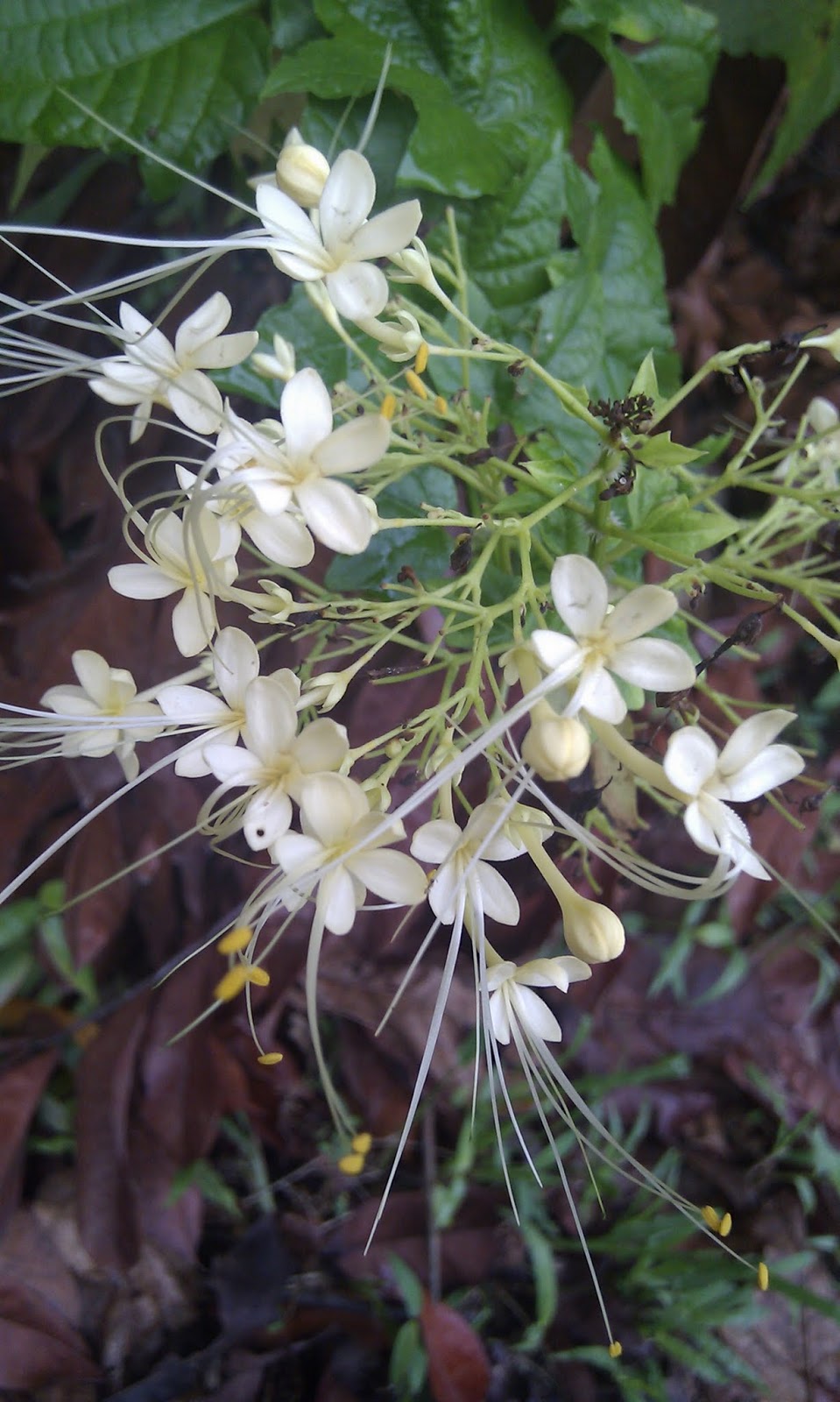
These are small flowers along the route.
On previous trip, I took the longer route to the Ranger Station. This time round I tried the shorter one. It follows along a fence beside Kallang Service Reservoir.
Unfortunately, the toilet at the Ranger Station is under cleaning. Look like I am going to endure till I am back to Woodlands.
Turning off from Sime track, I entered the Riffle Range Link. There is a small rock bearing the track name near the turning point.
Along the track I chanced upon a small building structure right in the middle of a stream. Don't know why it is there and its purpose of it being there.
I am surprised that I had to cross a stream without bridge on this track. Probably in dry seasons it is not a stream. Managed to cross it without getting wet (via the sand strip, stone and the branch in the picture).
Although the name is Riffle Range Rd, it is nothing that looks like a road in this picture.
Only after this point then there is a real road and it is still called Riffle Range Rd. Obviously, you won't be able to know where exactly is this point. My pictures are all geotagged. If you go to my WikiLoc or Picasa Web (Venus Dr to Hill View album) you can see the exact location of the pictures where I took it.
After the above point, the path is on road. Unlike newer roads, there isn't any pedestrian path all the way down. I had to walk on the road most of the time. On the way met a few uncles and unties of my age walking in opposite direction.
Along the road you can still see road markers for hikers. The color band is actually red but due to its reflective nature, it is white in the picture.
Since I dislike walking on the road, I actually planned to hike in a trail besides the road at this point. It follows along the road but is actually a walking and mountain bike trail. At a certain point further down, it cuts across the Riffle Range Rd.
There is a stone lined path near the road but it is so corroded that trekkers bypass it.
Once near the road you can see a sign board telling you that the trail is "Kampong Trail".
Across the road, there is a barrier at the entrance to the trail. It looks like a road and is actually a road with a name. There is actually a road name post on the right hand side of the picture. I can't remember the road name as the Android auto correct feature change it to some funny name. After doing a bit of searching. I think it is Senapang Road.
Along the road, took two flower pictures. The first one is a tiny flower.
Took the very first turn into another track. Along the way found a small water spring.
This path leads to Hindhede Rd. According to the plotted path, I took the PCN towards Bukit Drive. When I reached the end of the road that leads into a condominium then I realize the Google map error. OpenStreetMap shows that the correct path to take is to go on second turn on Senapang Rd. It does not show the first path. If you take the first path then turn left into Hindhede Road and then turn left into a path before a carpark.
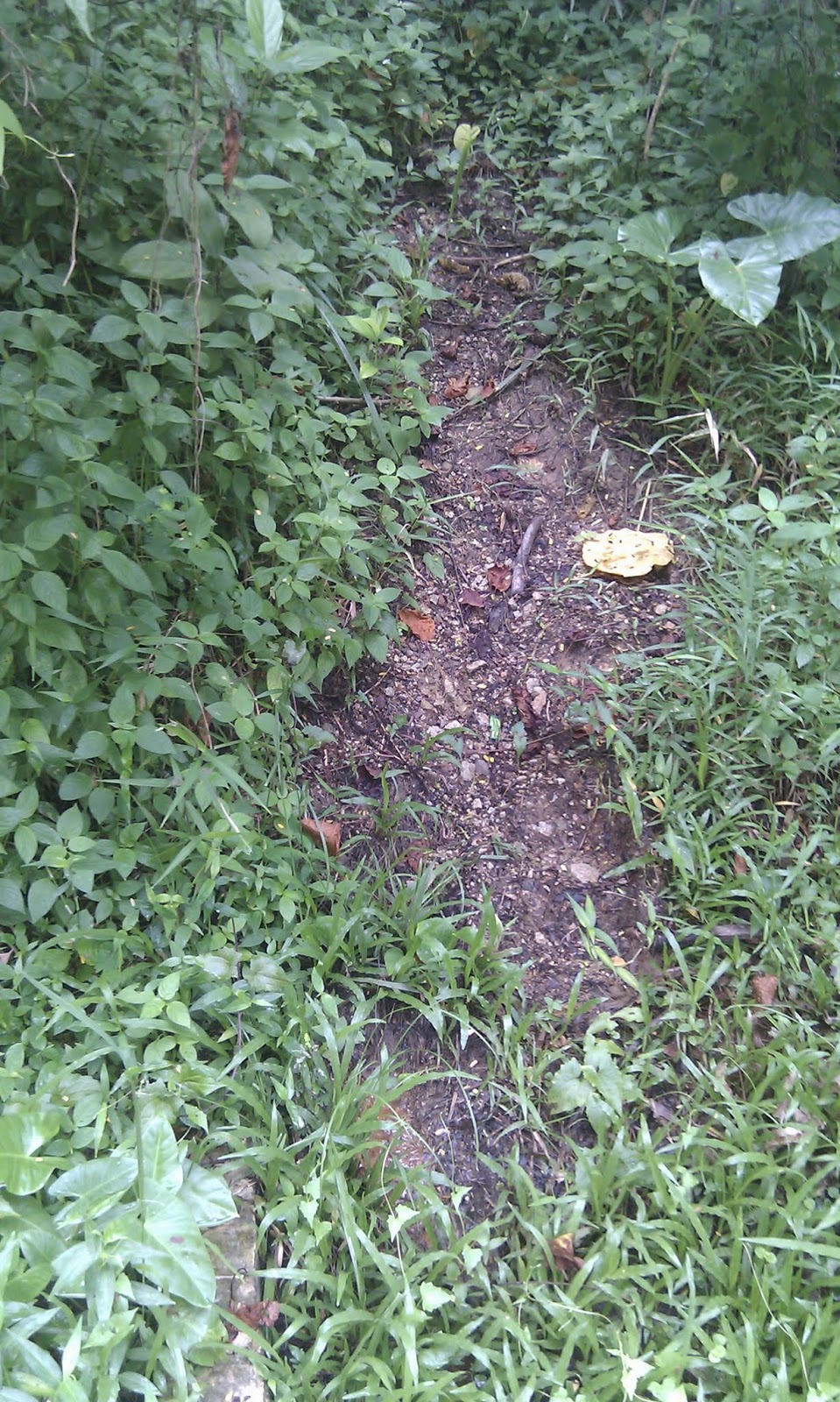
Any how, discovered a tiny path besides the Bukit Drive near the condo fence. Walked into it and the actual track is just a short distance away. Below is the picture of the path entrance. Notice how small it is. It is almost unrecognizable as a path.
There is a junction which is not marked in Google Map. I turned left walked along a almost covered path and found myself walking into a road. Checking the OSM, it leads to the query. I did not plan to go to the query thus backtracked to continue right at the junction. This is where I found a tunnel under the road.
Before that, I took a colorful picture of a flower or a fruit. Not sure which is which.
Further down, there is a sign board saying that I am in Chestnut Mountain bike trail. OSM actually marks it as one way trail.
Both Google map and OSM seems to miss this junction. Or may be this is GPS error. I have an unidentified junction further down the trail.
Turning left in the unidentified junction, and there is a road after a short trail. At the end of which is another trail that leads to another road. The latter leads into the Hill View PC. That is the end of the trail for me.
Took Bus Service 961 back to Woodlands after that.
The trail distance according to WikiLoc is 11.6KM but Endomondo indicates it as 14KM. I guess the latter takes into consideration the elevation distance as well.
http://www.wikiloc.com/wikiloc/view.do?id=4487623
http://sg.mapometer.com/walking/route_3103345.html
I started by getting to the MRT and took a train to Yishun. From there I took Bus service 855 to Upper Thomson Rd near Venus Dr. From there I walked into Venus Dr Carpark. I have hiked this part of the route before thus there is no difficulty in getting started.
It will be a bit boring to just take the path. Thus I look for things to take pictures on. Well, it is quite disappointing effort. Only managed to take two flower pictures.
These are small flowers along the route.
On previous trip, I took the longer route to the Ranger Station. This time round I tried the shorter one. It follows along a fence beside Kallang Service Reservoir.
Unfortunately, the toilet at the Ranger Station is under cleaning. Look like I am going to endure till I am back to Woodlands.
Turning off from Sime track, I entered the Riffle Range Link. There is a small rock bearing the track name near the turning point.
Along the track I chanced upon a small building structure right in the middle of a stream. Don't know why it is there and its purpose of it being there.
I am surprised that I had to cross a stream without bridge on this track. Probably in dry seasons it is not a stream. Managed to cross it without getting wet (via the sand strip, stone and the branch in the picture).
Although the name is Riffle Range Rd, it is nothing that looks like a road in this picture.
Only after this point then there is a real road and it is still called Riffle Range Rd. Obviously, you won't be able to know where exactly is this point. My pictures are all geotagged. If you go to my WikiLoc or Picasa Web (Venus Dr to Hill View album) you can see the exact location of the pictures where I took it.
After the above point, the path is on road. Unlike newer roads, there isn't any pedestrian path all the way down. I had to walk on the road most of the time. On the way met a few uncles and unties of my age walking in opposite direction.
Along the road you can still see road markers for hikers. The color band is actually red but due to its reflective nature, it is white in the picture.
Since I dislike walking on the road, I actually planned to hike in a trail besides the road at this point. It follows along the road but is actually a walking and mountain bike trail. At a certain point further down, it cuts across the Riffle Range Rd.
There is a stone lined path near the road but it is so corroded that trekkers bypass it.
Once near the road you can see a sign board telling you that the trail is "Kampong Trail".
Across the road, there is a barrier at the entrance to the trail. It looks like a road and is actually a road with a name. There is actually a road name post on the right hand side of the picture. I can't remember the road name as the Android auto correct feature change it to some funny name. After doing a bit of searching. I think it is Senapang Road.
Along the road, took two flower pictures. The first one is a tiny flower.
Took the very first turn into another track. Along the way found a small water spring.
This path leads to Hindhede Rd. According to the plotted path, I took the PCN towards Bukit Drive. When I reached the end of the road that leads into a condominium then I realize the Google map error. OpenStreetMap shows that the correct path to take is to go on second turn on Senapang Rd. It does not show the first path. If you take the first path then turn left into Hindhede Road and then turn left into a path before a carpark.
Any how, discovered a tiny path besides the Bukit Drive near the condo fence. Walked into it and the actual track is just a short distance away. Below is the picture of the path entrance. Notice how small it is. It is almost unrecognizable as a path.
There is a junction which is not marked in Google Map. I turned left walked along a almost covered path and found myself walking into a road. Checking the OSM, it leads to the query. I did not plan to go to the query thus backtracked to continue right at the junction. This is where I found a tunnel under the road.
Before that, I took a colorful picture of a flower or a fruit. Not sure which is which.
Further down, there is a sign board saying that I am in Chestnut Mountain bike trail. OSM actually marks it as one way trail.
Both Google map and OSM seems to miss this junction. Or may be this is GPS error. I have an unidentified junction further down the trail.
Turning left in the unidentified junction, and there is a road after a short trail. At the end of which is another trail that leads to another road. The latter leads into the Hill View PC. That is the end of the trail for me.
Took Bus Service 961 back to Woodlands after that.
The trail distance according to WikiLoc is 11.6KM but Endomondo indicates it as 14KM. I guess the latter takes into consideration the elevation distance as well.
http://www.wikiloc.com/wikiloc/view.do?id=4487623
http://sg.mapometer.com/walking/route_3103345.html
Location:
Singapore
Monday, May 06, 2013
What it takes to be an event organizer
To avoid fellow members from being agitated by this post, no names and specific description of the actions will be mentioned.
I am a member of a social club. It recently organized an event. It is a tough event that requires a lot of efforts from its member. Most of the members have not done such activity of this magnitude.
The very first thing to be done is to get members to participate. Since the event is not an easy one, not many wish to participate. A lot of efforts is done just to get enough people to take part. At one time, I was wondering whether there will be enough participants.
With enough trainers available, the organizer started a training schedule. Unfortunately, the attendance is less than enthusiastic. At times, less than a handful turned up for the training. At other times, the training is cancelled due to no response at all.
Some members did not even realize the challenge they are facing thus dropped out after trying it out during initial phase of the training. In the end, less than half of the intended group size took up the full challenge. Some members only took up part of the challenge.
As a group, it is natural that a T shirt is chosen to highlight the group during the activity. Again, the respond is mostly muted. I do understand that many prefer not to don such T shirts for a informal event. When the T shirts were finally done, one member even passed an uncanny remarks about it. So much for the effort.
Since the event starting point is quite a distance away, the organizer proposed to arrange for a transport to take the members there. The cost will be split among the members. The arrangement is cancelled due to very poor response. Members end up having to make it to the starting point on their own.
An effort is also done by the organizer to get supporters and helpers from other non participating members. This also ends in disaster. The organizer had to ask for external help. It is fortunate that there are kind souls that come forward to be counted.
During training, repeated instructions about safety and guidelines were given. Yet on the actual event day, some members did not heed the instructions and end up with accidents. Luckily it is only minor accidents.
Specific paths and actions were detailed and given to members. Yet on the actual day, members requested to take short cuts to avoid some difficult maneuvers. Some even said the paths taken is meaningless waste of effort. It is the challenge that is laid up for the members. If members wish to avoid such challenges then what is the point of having the challenges? At one point the organizer is so agitated that he burst out quite strong words about members' participation.
It is interesting that no costs were ever mentioned about the food and drink and other incurred costs. I guess the organizer borne all the charges. Members were not even aware of such costs.
Did I mentioned that it is mostly a one man effort on the part of the organizer? He took up all the necessary roles to make the event a successful one. I could only offer help in a very small way.
Face with such lukewarm attitude and uncooperative members, I really admire the stamina of the organizer to see it to the end. He really put up tremendous time, effort and costs to organize the event. I would have given up long ago.
If not for the persistence and insistence of the organizer, this even would have ended up cancelled. I must really complement the organizer.
As for the members, some could not even imagine that they could complete the challenge. In the end, they completed the whole challenge. It is the training that builds up the ability of the members. There is not a single drop out during the actual challenge. One who have decided to take only part of the challenge actually complete the whole challenge. At least for these members, the organizer's effort is not wasted.
I am a member of a social club. It recently organized an event. It is a tough event that requires a lot of efforts from its member. Most of the members have not done such activity of this magnitude.
The very first thing to be done is to get members to participate. Since the event is not an easy one, not many wish to participate. A lot of efforts is done just to get enough people to take part. At one time, I was wondering whether there will be enough participants.
With enough trainers available, the organizer started a training schedule. Unfortunately, the attendance is less than enthusiastic. At times, less than a handful turned up for the training. At other times, the training is cancelled due to no response at all.
Some members did not even realize the challenge they are facing thus dropped out after trying it out during initial phase of the training. In the end, less than half of the intended group size took up the full challenge. Some members only took up part of the challenge.
As a group, it is natural that a T shirt is chosen to highlight the group during the activity. Again, the respond is mostly muted. I do understand that many prefer not to don such T shirts for a informal event. When the T shirts were finally done, one member even passed an uncanny remarks about it. So much for the effort.
Since the event starting point is quite a distance away, the organizer proposed to arrange for a transport to take the members there. The cost will be split among the members. The arrangement is cancelled due to very poor response. Members end up having to make it to the starting point on their own.
An effort is also done by the organizer to get supporters and helpers from other non participating members. This also ends in disaster. The organizer had to ask for external help. It is fortunate that there are kind souls that come forward to be counted.
During training, repeated instructions about safety and guidelines were given. Yet on the actual event day, some members did not heed the instructions and end up with accidents. Luckily it is only minor accidents.
Specific paths and actions were detailed and given to members. Yet on the actual day, members requested to take short cuts to avoid some difficult maneuvers. Some even said the paths taken is meaningless waste of effort. It is the challenge that is laid up for the members. If members wish to avoid such challenges then what is the point of having the challenges? At one point the organizer is so agitated that he burst out quite strong words about members' participation.
It is interesting that no costs were ever mentioned about the food and drink and other incurred costs. I guess the organizer borne all the charges. Members were not even aware of such costs.
Did I mentioned that it is mostly a one man effort on the part of the organizer? He took up all the necessary roles to make the event a successful one. I could only offer help in a very small way.
Face with such lukewarm attitude and uncooperative members, I really admire the stamina of the organizer to see it to the end. He really put up tremendous time, effort and costs to organize the event. I would have given up long ago.
If not for the persistence and insistence of the organizer, this even would have ended up cancelled. I must really complement the organizer.
As for the members, some could not even imagine that they could complete the challenge. In the end, they completed the whole challenge. It is the training that builds up the ability of the members. There is not a single drop out during the actual challenge. One who have decided to take only part of the challenge actually complete the whole challenge. At least for these members, the organizer's effort is not wasted.
Thursday, April 11, 2013
Revengeful heart
There was a certain person in a FB group that I have joined that was removed from the group for flouting the group's regulation. The group specifically stated that ADS from shops were not welcomed only personal items can be sold in the group. Along the way, there were a number of warnings posted to remind people not to place sales ads. Obviously, this certain person ignored the rules and thus was removed.
I did not notice this hate behavior till I saw the person posts in another group that I have joined. In the ADS post, the person specifically indicated that members from the former group cannot buy from the shop unless they "dislike" the group. I was taken aback. Why would a person go to such extend to jeopardize his own business by discriminating against members of a group?
I am amazed that his hatred of the group admin is extended to all members of the group. Well, it is his own business that he choose not to sell to a certain group.
One hour later he posted another ADS offering huge discounts on certain products and is available to the same group's members only. The condition is that the members must post a picture of the product and like it.
That again amazes me. Has the person so blinded by hatred that he posts conflicting ADS? The first post stops all purchases from the group. The second post ask the same group to post a "like" before they can purchase with the discount. They are self excluding.
I posted a comment querying the conflicting message. The reply is that I am not able to keep up with the cyber speed. Without asking for clarification, I would assume that he invalidates his first post so that the second post can be viable within an hour. That brings another issue to mind. How would people knows your business trend if you changes your ADS that fast. Would your ADS become obsolete by the time I go to your shop? Furthermore, a black and white ADS is legally valid unless it is withdrawn. Of course, in this particular issue, the ADS is self invalidated by the second post. However, that does not clears the confusing message the person is posting to readers.
Business ethics is one thing. The point here is a person's rage could drive him/her to do unwise things. In the first place, you have violated the clearly stated group rules and ignored repeated warnings. Why do you fly into rage when your membership is removed? Clearly it is not the admin neither is the members' fault. If every one flout the rules then what is the rule for? Getting into a frenzy over your own fault is not a right thing to do. Jeopardizing your own business in this way is not a good way to earn a living either.
Hatred always follows by revenge. This is human nature. The urge to get back even is always one sure way to cause unrest. I am really sad to find such person doing unwise things like that.
I did not notice this hate behavior till I saw the person posts in another group that I have joined. In the ADS post, the person specifically indicated that members from the former group cannot buy from the shop unless they "dislike" the group. I was taken aback. Why would a person go to such extend to jeopardize his own business by discriminating against members of a group?
I am amazed that his hatred of the group admin is extended to all members of the group. Well, it is his own business that he choose not to sell to a certain group.
One hour later he posted another ADS offering huge discounts on certain products and is available to the same group's members only. The condition is that the members must post a picture of the product and like it.
That again amazes me. Has the person so blinded by hatred that he posts conflicting ADS? The first post stops all purchases from the group. The second post ask the same group to post a "like" before they can purchase with the discount. They are self excluding.
I posted a comment querying the conflicting message. The reply is that I am not able to keep up with the cyber speed. Without asking for clarification, I would assume that he invalidates his first post so that the second post can be viable within an hour. That brings another issue to mind. How would people knows your business trend if you changes your ADS that fast. Would your ADS become obsolete by the time I go to your shop? Furthermore, a black and white ADS is legally valid unless it is withdrawn. Of course, in this particular issue, the ADS is self invalidated by the second post. However, that does not clears the confusing message the person is posting to readers.
Business ethics is one thing. The point here is a person's rage could drive him/her to do unwise things. In the first place, you have violated the clearly stated group rules and ignored repeated warnings. Why do you fly into rage when your membership is removed? Clearly it is not the admin neither is the members' fault. If every one flout the rules then what is the rule for? Getting into a frenzy over your own fault is not a right thing to do. Jeopardizing your own business in this way is not a good way to earn a living either.
Hatred always follows by revenge. This is human nature. The urge to get back even is always one sure way to cause unrest. I am really sad to find such person doing unwise things like that.
Wednesday, April 10, 2013
Lower Pierce Reservoir - Bishan Ang Mo Kio Park Walk
This walk covers three areas. First the trails down the reserve. The reservoir goes next and finally Bishan Ang Mo Kio Park. The starting point is at Old Upper Thomson Road near Yio Chu Kang Rd. The nearest access point is the Carpark at Casuarina Road. The nearest bus stop is ID 56039. Available buses are 163, 167, 169, 855, 980.
The trail starts at Casuarina CarPark. Walk down the right side of the Old Upper Thomson Rd. You will see an information board besides a trail bridge.
If you look down at the trail bridge, you can actually see the trail name. This trail seems to be very quiet. I only see three individual or groups walking on the trail.
This trail bridge will lead to another information board where the Oncospemum Trails is.
You could exit back to Old Upper Thomson Rd if you turn left. I choose to turn right instead to the Reservoir.
The Oncospermum Trail is a bridge trail mostly over the edge of the reservoir. At the end of the trail, you will come across a fishing area marked as thus
The reservoir walk is an embankment of the reservoir. Here you can see quite a number of people taking a walk or jog.
Very interesting thing to observe is the ground. There are many areas that have grasses uprooted like this.
It is actually the work of Wild boars. You can see it all over the reservoir area. Unfortunately, there is no a single wild boar in sight.
The path come to an abrupt end at the flood gate. Beyond it is the Singapore Country Club golf course. One alternative is to walk back and take the road linking the reservoir to Old Upper Thomson Road. I choose to be more adventurous and walked along the flood gate drain. It is narrow and not a proper path.
Here you can see the drain. I actually walked on the right side of the rail. There is actually no sign saying I cannot walk there neither is there any sign saying one should not walk on the grass.
Further down there is two big water pipe blocking the way. I had to take to the grass patch to circle around it. There is actually a walking path on the left side of the railing. It is covered with grass but still walkable. There is a crossing available to the other side of the drain but there is no path available unless you want to walk on the grass patch. The drain will end up at Upper Thomson Road.
Upon crossing at the traffic junction, you will be in Bishan Ang Mo Kio Park already. This is a thin and long stretch of a park divided by the Marymount Rd.
It is only here that I can see warning signs about wild boars.
Took a few pictures of the trees, flowers, ponds etc.
The water lilies are quite nice but cannot take picture with Android phone as the zooming capability is very limited.
The above look like out of space. It is actually a slide in the children's play ground. Further down there is a much longer slide like this.
You will seldom see comfortable bed like chairs in Singapore. This is one place where there are a number of reclining chairs like this.
To blend in to the environment, this shelter is made to look like a leaf. It is a metal structure with covered canvas.
Took me quite some time to get this picture. The android is just not that suitable for manual exposure adjustment.
Very colorful weed near the stream.
This picture was taken at the other end of the park near Bishan Road junction with Ang Mo Kio Ave 1. There is a bus stop (ID 54539) on Bishan Road. Available buses are 53, 55, 58, 156, 162, 162M. Alternatively, you could walk along Ang Mo Kio Ave 8 to Ang Mo Kio MRT. It is about three to four bus stop away.
The total distance walked is 7.1KM. If you want to take the walk, you can follow my trail at http://www.wikiloc.com/wikiloc/view.do?id=4264937
The trail starts at Casuarina CarPark. Walk down the right side of the Old Upper Thomson Rd. You will see an information board besides a trail bridge.
If you look down at the trail bridge, you can actually see the trail name. This trail seems to be very quiet. I only see three individual or groups walking on the trail.
This trail bridge will lead to another information board where the Oncospemum Trails is.
You could exit back to Old Upper Thomson Rd if you turn left. I choose to turn right instead to the Reservoir.
The Oncospermum Trail is a bridge trail mostly over the edge of the reservoir. At the end of the trail, you will come across a fishing area marked as thus
The reservoir walk is an embankment of the reservoir. Here you can see quite a number of people taking a walk or jog.
Very interesting thing to observe is the ground. There are many areas that have grasses uprooted like this.
It is actually the work of Wild boars. You can see it all over the reservoir area. Unfortunately, there is no a single wild boar in sight.
The path come to an abrupt end at the flood gate. Beyond it is the Singapore Country Club golf course. One alternative is to walk back and take the road linking the reservoir to Old Upper Thomson Road. I choose to be more adventurous and walked along the flood gate drain. It is narrow and not a proper path.
Here you can see the drain. I actually walked on the right side of the rail. There is actually no sign saying I cannot walk there neither is there any sign saying one should not walk on the grass.
Further down there is two big water pipe blocking the way. I had to take to the grass patch to circle around it. There is actually a walking path on the left side of the railing. It is covered with grass but still walkable. There is a crossing available to the other side of the drain but there is no path available unless you want to walk on the grass patch. The drain will end up at Upper Thomson Road.
Upon crossing at the traffic junction, you will be in Bishan Ang Mo Kio Park already. This is a thin and long stretch of a park divided by the Marymount Rd.
It is only here that I can see warning signs about wild boars.
Took a few pictures of the trees, flowers, ponds etc.
The water lilies are quite nice but cannot take picture with Android phone as the zooming capability is very limited.
The above look like out of space. It is actually a slide in the children's play ground. Further down there is a much longer slide like this.
You will seldom see comfortable bed like chairs in Singapore. This is one place where there are a number of reclining chairs like this.
To blend in to the environment, this shelter is made to look like a leaf. It is a metal structure with covered canvas.
Took me quite some time to get this picture. The android is just not that suitable for manual exposure adjustment.
Very colorful weed near the stream.
This picture was taken at the other end of the park near Bishan Road junction with Ang Mo Kio Ave 1. There is a bus stop (ID 54539) on Bishan Road. Available buses are 53, 55, 58, 156, 162, 162M. Alternatively, you could walk along Ang Mo Kio Ave 8 to Ang Mo Kio MRT. It is about three to four bus stop away.
The total distance walked is 7.1KM. If you want to take the walk, you can follow my trail at http://www.wikiloc.com/wikiloc/view.do?id=4264937
Subscribe to:
Posts (Atom)