Friday, December 12, 2014

What does a 60X magnification on a digital camera means

I am always troubled by the magnification factor of digital cameras. Recently, there is an advertisement about a camera that could zoom 60X. Now if that is a DSLR standard then it will be 3000 mm super telephoto lens. A standard lens is 50 mm (1:1 view) If you see professional camera man, you will notice that they carry camera with super long lens and that is generally a 1000 mm lens. It is thus impossible that a compact camera have 3000 mm focal length lens.

In actual fact the magnification on a compact camera is a negative magnification type. That is to say you set the maximum focal length then you could zoom out to view more areas. Taking the Nikon P600 as an example. The focal length is about 4.3mm to 258 mm.  To a standard 50 mm lens, 258 mm is about 5x and 4.3 mm is -12x. So you practically can zoom in to 5x for a telephoto and zoom out 12x to get super wide angle.

For a person who likes telephoto zoom, 5x is generally not good enough but is sufficient for not-so-far-distance shots. 12x wide angle shots will be useful only if you are in a very tight spot like shooting a large building on the edge of a steep slope. Consider the aperture of F3.3-6.5 (P600), practically you can only shoot at bright light condition without flash.

The conclusion is that it will be convenient camera to carry around but don't expect very good quality photos when you play with telephoto shots. Moreover, at 100 mm and above, you practically need tripod. There is no way you could shoot a picture free hand using telephoto. The convenience is totally lost if you need to carry an extra tripod.


Saturday, November 29, 2014

Publishing a map with Map Engine

I have used a number of mapping programs to create routes. They are route based programs. I have also used "My Map" (Google) to create maps with routes and other information. The most notable one  is PCN on Bikes. It was later recreated into the Map Engine Lite as New PCN on Bike.

The former has been migrated to the latter. That caused a problem. There is a maximum of 5 layers and no Custom Icons. Also the uploading is limited to 500 items per layer. I can't just import and export the whole map in one go and I can't upload the old PCN on Bike onto the new. It took me quite some time to redo the whole thing in the LITE version. The result is a map that uses default icons and just 5 layers. I is not pleasant to look at. Thus it is important for me to look for alternatives.

One alternative is to pay $5 per month for the PRO version. However, the limits is just extended to 10 Layers and 2000 items. It probably served all my purposes but  I refused to pay for it. I am not running a business on the map and gains nothing from it besides the praise from uses. One friend offers to sponsor me. I am hesitant to accept it.

One other option is to use the Map Engine evaluation. It is something like PRO but with 80,000 load traffic and 10 MB data size limits. It allows custom icons and large number of layers. This looked good.

It is a hard time trying to use Map Engine though. Firstly it does not have editing feature. Luckily it can import KML files. Thus I imported the KML from the Map Engine Lite and after a long and tedious process of uploading to the Data Source, adding to Layer and then adding to Map. I managed to create a seeable map. I thought that will be the end of the story.

On helping another group to create a map, I realized that there is an app in Android called "My Maps". It can load the maps onto the hand phone and view it on the go. That is great news till I viewed it. The map cannot be loaded reason being that the app cannot load map with KML layers. That is a huge let down. If it can be loaded then surely it should be displayed.

I guess Google does not want Google Engine to be use by the Map Engine Lite people to by pass the custom icon and layer limitation settings. If it can be easily imported into Map Engine then they will loss considerable business.

I am then left with no choice but to find alternatives. From the upload dialog, I find that it accepts uploads in shapefile format (SHP). A SHP file is basically a vector file. Thus I must convert the KML to shapefile first. Now, how do I do it? I simply have no idea. There are a few converters that is available to convert KML to SHP bu tthey all fall short of expectation. In fact, I don't know that the Map Engine only accepts points (markers), lines and polygons. Thus all I get is lines and round dots for the markers after conversion.

An effort is thus done to find a vector editing file and one that could import KML files. QGIS appears in the search. I downloaded it and installed. On first run it pops up a dialog to define map projection definition.

I was dumbfound. What in the world is that? I simply have no idea as it is the first time I use a GIS (Geographic Information System) editor. I edited OpenStreetMap before and it is a web based one. It is just a graphic editing system which draw lines and polygons. It does not even require any definition and I have no idea what format it stores the data.

Searching internet, I finally found out what is it all about. I also find out what Google uses in its maps. It uses WGS64 format. For example a coordinate reference to a point in singapre is Lat 1.26503 Long 103.82193 (Vivo MRT). I have been using this in OSMAnd (Android Map app)  without even knowing it.

With the CRS set, I was then prompted to select a location. It showed the world map. Again I was intimidated. I cannot zoom into the map and select an area. The only way is to select from a list and Singapore is simply not in the list. It ended up I choose Malaysia and then add a bit of offset to it to ensure Singapore is covered.

The Application appeared after a long wait. It was a blank work space with a lot of toolbars and panels. Third time whammy. How to draw a line when you don't even know where to put it?

After looking at the menus I finally find an item called "Vector" in it there is a item called "OpenStreetMap". I thought that is it. So I click "Download data". After the data is downloaded, I am still looking at a blank screen. On searching internet again. I found out that I had to "Import topology from XML" then "Export topology to spatialLite". I don't know what in the world is that but followed faithfully to do three downloads for each type (line, point, polygon).

Well, it is not surprising that I get a blank area again. This time there are three items appearing on the left panel. I left click and find an item called "zoom to layer". A wire mess appeared with large patches of green. Finally I get something. On zooming in I can see Malaysia. Zooming in further, I finally get to see Singapore. It was covered with green and a huge mess of wires but at least I can recognize that it is Singapore roads and buildings. On playing further I managed to turned off the points and polygon thus leaving less clustered screen. Well it is not what I expected but it will do.

The next step is then to import the KML. That is pretty easy. There were instructions in the internet. So I imported the maps from my map. Finally I get to see my map and the not so nice base map of OSM.

The import looked ok except the Notes layer. It is just a bunch of circles. I managed to get the line layers to show its lines with a different color using styles. But struggled to define the Notes. There is no individual style setting. The Categorize style also don't allow selection of icons. I ended up choosing "rule based". I was tough trying to set the rules as I did not organize the Notes in the rules style. After a lot of trial and error, I managed to get it done. I am yet to use custom icons at this stage.

The next step is to load custom icons. It is again a challenge to do it. But via internet I managed to get it done with SVG icons. I learned SVG coding before thus it is easy for me to create the custom icons. In actual fact the icons in the first version of Google map was originally created using SVG.

It is the first time I feel that at least there is something familiar between QGIS and Google Map. The happiness was short lived. After I upload the vector maps into Map Engine. I get the same mess as when I converted the KML in QGIS. All the settings in QGIS is missing. There are also waning that some lines exceed the 50 vertex limit. I simply let go and take a break.

After thinking over whether to continue with the fiasco, I decided to push on. It is never my habit to give up so easily. I redo every style in Map Engine. It is yet another learning curve for me. When coming to style the Notes, I am faced with another challenge. There is no SVG icons. So I converted all the SVG again to PNG. But the conversion does not make the background transparent. At least I don't know how to do it in Inkscape (a SVG editor). Well that does not deter me. The graphic viewer in my computer has the ability to convert graphic formats. I simply use it to make GIF files with transparent backgrounds. It worked just fine. Now I have custom icons.

The next thing to do is to break the lines so that it is within the limits. Gosh! That is some thing I am yet again struck with unbelief. The layers simply cannot be edited. After a while I managed to toggle the editing feature. It is a safeguard system in QGIS. The next question is then how to break the lines into two. Even Map Engine does not have that feature. Well, at least I am lucky in this. There is a feature to break the lines. It is hard to use in the first time round but I managed to get it working.

On uploading to Map Engine, I discover that it does not replace the old resource. It simply creates another one. I really vomit blood on that. Map Engine is just not user friendly. I had to unpublish the old map, unpublish the old layer then unpublish the resource to remove the old one then reverse the process to add the new one. In the process the style gets lost. I almost utter the Fxxx word. Fortunately there is a "import rules from another layer" feature. I really heave a sign of relief. I am yet to try it on Notes but I am confident it can be done.

While I was trying out, a friend wrote to me about some errors in the PCN layer. It has some lines overlapping the Others layer. So I tried to edit it in QGIS. Well, that poses a problem. I just don't know how to edit besides deleting, moving the vertex (the joins in the line) and breaking the line. There is simply no facility to do that. Well, there is a plugin feature. So I tried to look at the long list of plugins and then I discover that Google has a plugin for QGIS. Wow! that is something. Unfortunately, I had to learn how to use it.

After a lot of trial and error again. I managed to make the connection. Now uploading to MapEngine is a wee bit easier. It is just 3 clicks away.Cool. The uncool part is that it still does not override the old uploads. Well, at least I can live with it.

Actually, that was not what I originally wanted to do when I look at the plugins. I get carried away. So, it is back to the search. I managed to get a few plugins that deals with editing. The first one is to join to features (lines). If I break it, I must be able to join it. The other one is to extend the line. It is not as easy as Map Engine editing where you click on a segment of a line and you can add a new vertex but at least I could combine the breaking, extending and joining to achieve what is just one simple step in Google. Hopefully I don't need to add a lot of vertexes.

Well, with all that,  I am at least able to use Map Engine to publish maps with custom icons and multiple layers just like the original map. It will be hard work but at least it can be done.

There was a little surprise I get when I tried to learn more about QGIS. I discovered that the base map can be loaded easily by the menu item "web". I never click on it as I though it might be some links to the internet. In actual fact, it can load a number of different base maps beside Google map. The previous attempt to load OpenStreetMap is simply for the wrong purpose. Well, I am dumbfound.

There is one more thing I had to do. You see, Map Engine pose a page loading limit per month. I had to get my map to be free of the limit by putting it in the Google Map Gallery. Some of my maps automatically gets published in there but not my Map Engine map. Fortunately, there is a link to do it in the map engine itself. So I just submit it by filling a form and in a day's time it was approved. Hopefully Google will remove such mundane limit in future. I do understand that Google need to make a profit. There are some idiots like me who simply want to contribute to the society free of charge. After all, I gets nothing from the work beside the "thanks" from users.

For a person who know nuts about GIS, the attempt is very foolish to some. To me it is just some challenge which I take on to do what I wanted to achieve. It may have a lot of fumbling and mistakes without proper training but since when I did proper training for most of the things I do before starting. My next blog will show you how many times I venture into something totally new without any training.

Latest update. Google Map Engine is no longer available. After all the hard work and it is no longer available in less than three months. Its really a waste of time and effort.


Sunday, October 19, 2014

Bukit Timah to Caldecott

This is perhaps the longest hiking route I ever had. It is 18.7 KM according to Endomondo. I did not put this route in WikiLoc because it is just a combination of the previous hiking routes.

The route started at Bus Stop near Pei Wah Ave. The intention is to go all the way north to Jln Anak Bukit but was distracted by the construction at the junction thus ended up in Jln Jurong Kechil. I only realize the mistake after walking almost a kilometer down the road.

On Consulting the map, there seems to be a private estate that is accessible across the road to cut across it. I took the chance and went into it. Unfortunately, I made another wrong turn to the left instead of to the right and thus missed the road that goes into the estate. I end up going on the outskirt of the estate with an unmarked road and come to a dead end.

Looking at the map again, the Bukit Regency was right in front and the perimeter fence seemed to be accessible. I decided to walk around the Regency perimeter fence. A huge mistake. The clearing outside the fence ended after I walked a hundred meters. It was just grass covering the area beyond that. I decided foolishly to continue walking across as it is only a matter of two hundred meters more.

After bashing through the knee height grass and get my shoes and sock all wet due to the dew, I managed to reach Upper Bukit Timah Rd. It is a foolish move but is still enjoyable. Fortunately, there is no obstacles that I could not manage. The round about added about two kilometers to the hike.

The actual hike starts at Hindhede Dr. Spotted a bird right at the entrance of the trail. Waited 5 minutes for the bird to emerge from its nest but failed. The bird settled down in the nest. Disappointed but had to move on.

A while later a Male Black Archduke gracefully fly around me and settled down for me to take a picture. There are at least three different specie of Archdukes in Singapore. It is a bit hard to distinguish between them. The male is slightly easier to differentiate but the females were way too similar.


Further down the path there is a Pear-Shaped Leucage spider enjoying its meal.


A distance down the path and I caught sight of a Golden Orb Web Spider. The wind is continuously blowing thus the picture is quite blur.


After the Kampong Trail, the path goes into open fields. This portion is a wide cycling route. The Zanziba Yam is small but since it is so near, I could zoom in to the max.


An Orange Leafhopper (a kind of Cicada) popped on a leaf and I am obliged to take a picture of it.


After crossing Riffle Range Road I saw a Spotted Dracaena blooming. This plant flower previously took me a long time to find its name. It is the first time I saw the flower blooms. Notice the spotted leaves? That's where it gets its name from.


Further down the trail, I saw a Heart Leaf Ivy. Unfortunately there is no flower.


Dark Brand Bush Brown is small and is very common. It is kind of difficult to identify with many species that look alike. This one insists that I took a picture of it. It flew right in front of me and stopped at elbow level.


The Common Baron is easier to recognize.


On approaching Durian Trail, I made a mistake without looking at the map. I went into a wrong trail way ahead of the trail junction. I mistook the sign post to be at the junction of the loop. The trail lead to a dead end. Turning back, I went into yet another wrong trail. This time I am rewarded by spotting a Common Faun.


Further down I saw a female Archduke.


Female Archduke is very hard to recognize. The camera I had performs badly in dim light. The picture is very grainy thus making ID very much more difficult. According to information from internet, the Black Archduke has all black antenna. You can see from the picture that the antenna is no where to be seen as it is moving way too fast to be captured. The Common Archduke antenna is bright orange and the fourth row of the spots on the body is larger than the black Archduke. This one looks like it is a Common Archduke. However, another picture of it showed its color that looked much more brownish although its antenna looks orange. This is where the Yellow Archduke come into mind. The Yellow Archduke is dark brown in color and its antenna is yellow on the tip. It is very confusing. It ended up I decided to ID this as Yellow Archduke. But posting in FB group ended up with a member giving its name as Black Archduke. I am totally confused.

Meanwhile, I trekked back to the right trail again following strictly to the GPS map trail I plotted. Two mushroom was spotted. One is unknown the other is a Bracket Fungus.


A Common Five Ring flew near by and I took quite some time waiting for it to settle down.


Ypthima species also looked quite similar. They are identified by the rings on the lower wing. You can see that there are 6 rings here. Well, the last two is counted as one if the yellow ring merged. This was unknown to me till I saw a blog that describes how to spot this specie. Luckily, I had only one other picture of this specie previously but never get published because of the confusion I had between a five ring and a six ring.

After taking the picture of the Five Ring, I notice something moved near my shoe. It is a Many-lined Sun Skink. This lizard usually runs away quickly even before I approach. This one is perhaps still sleepy. Noticed that the angle of the shot is almost straight down?


There is nothing much to see along the Riffle Range Road. At the Riffle Range Link (which is actually a trail), I spotted another female Archduke. This one is quite worn out. It again looked like a Common Archduke with its antenna visibly orange despite the grainy picture. Again the antenna looked orange but not the "widely orange" as described. Moreover, the color of the wing is still brownish. I decided to iD it as Yellow Archduke again.


While walking and looking around, I walked right into yet another caterpillar hanging from a tall tree. I never expected it as the tree is way too tall. This is a Bagworm Moth caterpillar (Psychidae). There is no way to ID it as it does not come out of its home.


Before crossing over to Sime Track, I spotted a branch with pinkish fruit or flower bud. Could not ID it.


At the Golf Link trail, it started to rain. Nothing much of the wild life will be available if it rains. I spotted one bird far away resting on water weeds. This is most like a Great Egret since I zoomed in from the distance yet still able to capture a good large image of it.


Walked a long distance without seeing another wildlife due to the rain. Saw a tiny flowering plant close to the end of the golf course. This is a Curvedflower Chasalis. The flower is indeed curved near its receptacle.


At the Lorne Trail, a Malayan Viscount come out in the rain.


A very old Branded Imperial also appears.


Almost at the end of Lorne Trail I spot a blackish butterfly resting on a branch. Had to use flash in order to capture the image. This one is a Saturn.


A few Pacific Swallow were resting on the rails of the curved bridge probably finds nothing flying due to the rain.


I ended the trail at Caldecott MRT without having any luck of another picture.

Not many pictures are available thus I will omit the Picasa Web album address. Since I did not record the trail in WikiLoc, there is no trail maps available too.

Thursday, October 16, 2014

Celebrity Endorsed Products

Each year companies spent billions getting celebrity to endorse their products. It is due to the fact that customers likes celebrities. Just by appearing next to the product automatically attracts eyes.

Ideally, when a celebrity endorses a product, it means that they have chosen the product for their quality or features. This applies especially to those who excel in their profession. Some of the endorsement means that they have to put on the product when doing their profession. Others simply took part in the ads for the product. Yet other simply allow their face and signature to appear next to the product ads.

In actual fact, most if not all celebrities endorse the product for money. As long as the company pay them, they will endorse anything. Thus the ideal remains ideal and has nothing to do about the product. If you do a search with this title and add "go bad", you will find tons of jokes about bad endorsement celebrities. Famous celebrities end up damaging their own image because of that.

One typical local celebrity endorses "Pawn shop". I would say that is a bad choice. Others like e-cigarette endorsement is simply a bad move. Are they encouraging smoking again? In the 50s celebrity endorse cigarettes and cigars. Many junk food company used celebrity to endorse their products yet we nowadays encourage eating healthy food.

As a consumer, if you buy products just because celebrities endorsed it, you may end up with a bad choice and probably wasted money on it. The best choice is to ignore the endorsements and compare the products. Choose which ever that suits you rather than what the celebrities says otherwise.


Thursday, September 25, 2014

When to call it quits

Most people will try to achieve something in their lifetime. Many will take on a challenge beyond their capability. After facing so much failure, will you call it quits.

For example, I was going for a very long distance cycling trip. The leg start to cramp after 120KM. It cramped so bad that I can't even move my leg. I decided to push on after resting till the cramp goes away. 20KM later another cramp started again. I rested again and continue. A third cramp started after just 3KM. This time it is on both legs. I can't even walk. Luckily I have stopped at the traffic light and there is little traffic. Do I call it quits? It is just another 17KM away to my destination. I pushed on and completed the route.

That is only a simple example. What about people like Abraham Lincoln? He lost 8 elections, failed business twice, get rejected in job applications. He is the typical example of those failed many times but in the end succeeded.

Obviously you only see those who succeeded. What about millions others who tried but never succeed? So when it is time to call it quits.

Actually, there is no such thing as "call it quits". How would you know if your next try won't turn out to be successful? But, I am not saying that you must keep on trying. Many will give themselves a limit. If that limit is reached then they gracefully let it be. Now that is not equal to quitting. Who knows when there is a new opportunity to try again? It is better than just quitting it all together. By letting go, it could also stops your mind bottleneck and fresh ideas may come out after a rest.

In my programming work, I used to hit bottlenecks. No matter how long I tried, the result just won't come out correctly. I stopped and try to do something else, after a while fresh ideas came right in and I am able to complete it exactly as expected. If I had quit then I will never get the result and settled for something less.

Do try to achieve what you wanted but don't push yourselves so hard that you keep repeating the same mistake and become stagnant with no result in view.

I like to end this note with an anticlimax. In this world there are still people who believes that the earth is flat. They stuck to the idea despite overwhelming proof that it is otherwise. Don't be such people. Accept that you are wrong in the first place and quit already.


Monday, September 22, 2014

Toll Charges

Singapore increased VEP (Vehicle Entry Permit) on 1 Aug 2014. The purpose is to limit vehicles entering Singapore between 2 am to 5 pm. Beyond the time limit it is free. On school holidays, the time frame is 2 am to 12 pm. This seems to be in line with the concept of limiting the number of cars in Singapore.

Malaysia ups its toll charges on the same date. It also introduces new toll charges for travelling from Johore to Singapore. That means the toll applies both direction.

Since Singapore only charges a fee for vehicles exiting Singapore previously, LTA anounced that Singapore will match the toll charges set by Malaysia. It couldn't be less fair to do so.

However, this means that each car will have to pay 5.7 times on a return trip. It is a heavy load to those frequent travelers.

There are a lot of complaints obviously. Many said that it is unjust to do so. Many blamed LTA for blindly matching the charges.

It is true that Singapore increased the VEP first. However, the purpose is not to increase the toll for vehicles entering Singapore. It does not have entry toll in the first place. It does allow free entry beyond the stipulated time frame though. Thus it should not be viewed as entry toll charges.

Malaysia obviously take it as a toll increase regardless and thus it adjusts its toll rate too. But VEP is for vehicles entering Singapore, thus Malaysia introduces new toll for vehicles entering Malaysia. Now that is a toll that applies at all times and it applies to both directions.

LTA subsequently announced that it will match Malaysia toll charges on top of the VEP as Singapore does not consider VEP as a toll charge. Why does LTA matches the toll charges? Well, VEP is for foreign vehicles entering Singapore during working hours. Toll charges is for ALL vehicles entering Singapore. It is a very different thing.

Since Malaysia says it is to pay for the maintenance of EPL which, according to a commentor in TODAY, is not necessary means that vehicles using the EPL need to pass through CIQ, it simply means that the toll is for vehicles entering and exiting Malaysia. Surely it is not unfair for Singapore to match the tolls in the same way.

In the end, the vehicle user had to fork out the extras regardless. For those Malaysians working in Singapore and those Singaporeans in Iskandar and else where, it means they have to pay for the extras each day.  It is a loss loss situation.


Thursday, September 11, 2014

Old Clementi Railway

Old Clementi Railway is an abandoned railway. This railway is the former Jurong line which is 14KM in length. What is left of it now is just a few sections of decaying rail tracks. This trip does not try to trace the complete 14 KM. The effort is just to try some section of it along Ulu Pandan PC.

Due to convenience sake, the trip starts at a bus stop near Nan Hua Primary along Commonwealth Ave West. A walk to Jln Lembing then Faber Dr with the intention to find one section still indicated in OpenStreetMap (OSM). Unfortunately it is totally not accessible. I have no choice but continue through a park to climb up a staircase to access to Faber Heights an thereafter to the Ulu Pandan PC.

The first plant seems new to me. I guess it is a Memecylon but could be a Syzygium instead. Unless the flower blooms, it is very hard to judge. This plant is at Faber Walk.


Along Faber Walk, there are quite a number of Red Powderpuff trees with bees flying around. I did not take any picture as the flower is relatively small and not so nice.

There are quite a number of private housing along Faber Heights. I saw this Starfruit tree with flowers and fruit.


At Ulu Pandan PC, there is an opening at the undrepass of Commonwealth Ave West. It seems to be quite close to the rail track. I walked over it and did see the track in front and behind me. I walked backwards towards the west to see where it leads and to my dismay it only last a couple of meters before disappearing totally but I can still see an opening in front. Since the distance backwards is quite short, I decided to continue forward to the east instead.

One thing to note is that I am not keen to take pictures of the rail. The trip is basically a flora fauna photography trip. http://remembersingapore.wordpress.com/singapore-railway/ has a much better documentation on the track.

A short distance after the underpass, the track actually goes underground. It is probably due to land fill near the Singapore Buddhist Youth Mission. I strayed into a garden to the left and talked to a old gentleman who is tending to the garden. He kindly told me that the rail is indeed under ground. He suggest me to continue walking above the land fill and the track will be further down the opening.

From the map it is indeed a walking path indicated instead of a rail track. I took the advice and continues the trip. The track appears near underpass at Clement Ave 6. To the right of it is some sort of garden or farm. To the left it seems to be an abandoned building site.  I tried the right hand side when I reached a crossing where a path leads to HDB Blk 305.

The abandoned building looks weird. It is more like a cemetery site but without any tomb stones. It looks like a Muslim burial site but I can't make out the tombs thus backed out of the place.

I went to the right into the farm/garden. There is a sign board that says it is a temporary garden.   Here I took a few pictures of a Passion fruit.


A spider egg nursery is found but I just can't find any information besides that it is probably a Jumping Spider egg sac.


There are, of course, some other plants but they are too common to warrant a picture of it. I contined the track and came to an end before an overpass across the PC and the river. The crossing is probably too dangerous for people so it was blocked up. Just before the overpass, the rail actually hangs above ground with its sleepers still attached. This is probably to the land sunk in below it.

Luckily there is a foot path leading down to the PC. I continued down the PC to cross the river further down.  This Cockspur Coral Flower along the river looks too nice to miss.


After crossing the river, I go back towards the rail. There is no footpath that leads to the rail so I just had to make one. Managed to take a picture of the rusty rail crossing.


Right after I reached the rail that I realize there is another blocking of the rail overpass above Sunset Way. I had no choice but to walk towards it then climb down by the side to reach Sunset Way. Crossing the road, I tried again to climb up to the rail as there is again no footpath leading up. Had to resort to all four limbs just to do that.

To my dismay, a few meters down the rail and the path ended with a "No Trepassing" sign board. Being a law abiding citizen, I had to end the trip right here. I would very much like to continue to the Green Corridor but resisted from doing so.


Just before I turned off, I saw a blue dragonfly.


Walking along Sunset Way,  I took a picture of a Malayan Eyebright out of boredom.


The trip is a disappointment. Not much nature pictures available and a lot of obstacles and detours. I would not encourage others to follow my footstep thus both the album and track info are omitted. Anyhow, the route is 3.9 KM. The actual track is probably 1/4 of it.

Thursday, September 04, 2014

Conflict

The following is purely fictional. 如有相似, 纯属偶然.

One is a member of  a community. The other is the community's leader. The member felt strongly that some thing has to be done. The leader felt that the member is too pushy.

The member gets more vocal, The leader feels that the member is telling him what he should do. The member starts to get other members involved. The leader felt that the member has gone beyond tolerance.

The result is that the member gets expelled. The member gets so mad that he starts to say things that are conflicting by itself.

Who is wrong? I guess all are. Who is right? I guess both are. It all boils down to whose side you are on. I guess others should not take sides. It is a situation such that neither can see eye to eye. They just do what they think is right. The result is a broken relationship.


Saturday, August 16, 2014

Green Corridor Walk

The first time I went on Green Corridor is when LCSG organizes a cycling trip. Did the complete route from Kampong Bahru Rd to Woodlands Rd. This trip is a shorter version of the same route and is on foot. The trip start from Majilis Hang Jebat (Queenstown) to Hill View Rd.

The trip actually starts from Queensway at the bus stop just before Portsdown Ave. Unknowingly, I pass through a plot of land that is "no trepassing". I only noticed the sign board near to the Green Corridor and is facing the Green Corridor.  I should have gone to the junction between Queensway and Portsdown Ave instead.

Anyhow, it starts drizzling even before I gone onto the Green Corridor. I had to take refuge at the Hang Jebat Mosque to wait for the rain to subside. A friendly Malay wave at me just before I exit the mosque.

The very first picture taken is actually at Queensway near a car park into the plot of land. It is a White Clock Vine.


Not far from the mosque, I saw this Common Sailor.


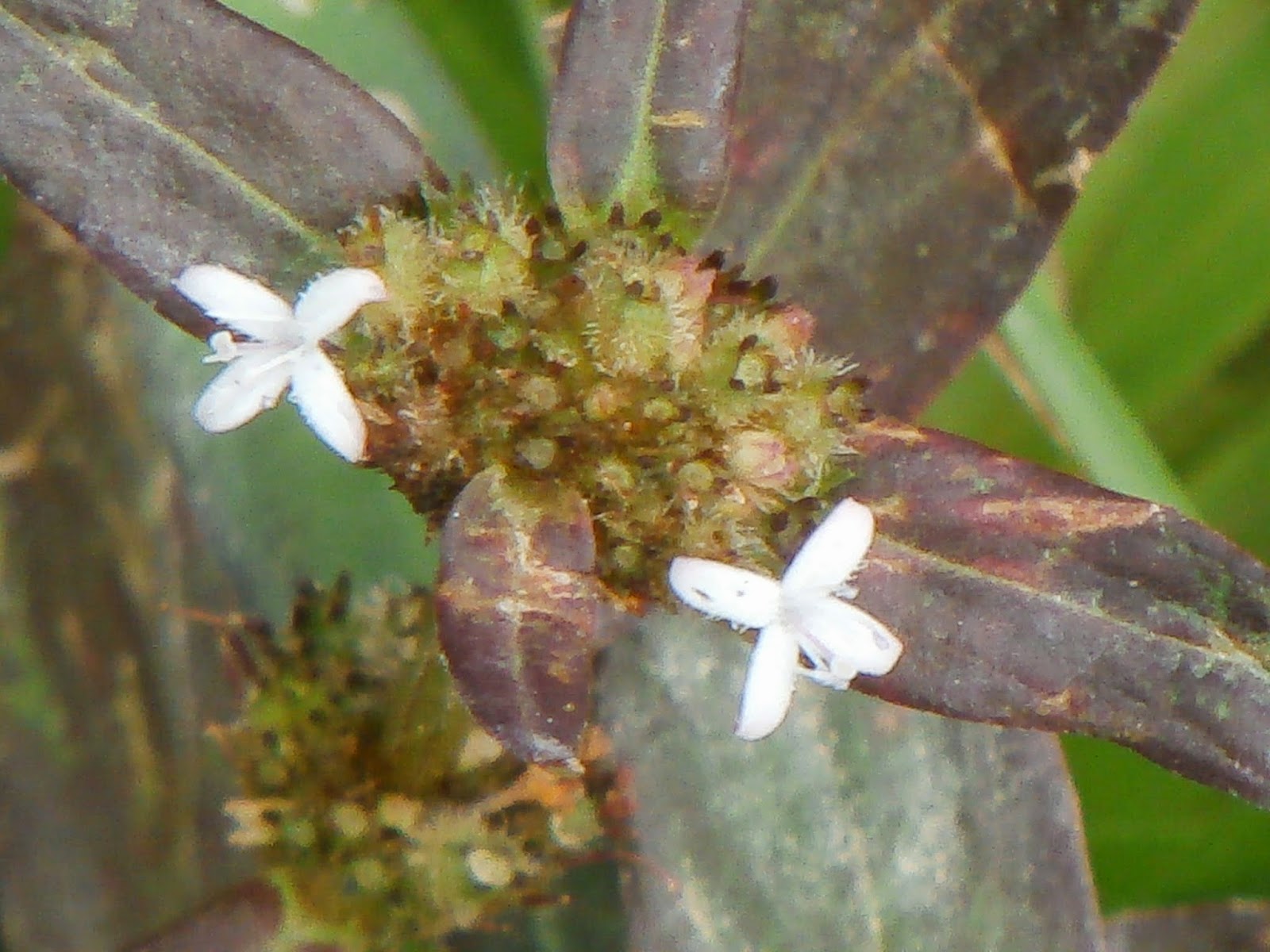
The larger version of the untouchable Mimosa is this Catclaw Mimosa. Its name probably come from the dried fruit.


The root of this plant can be eaten. It is a Tapioca in the wild.


The Dark Band Bush Brown suddenly come in pairs as I focused on the first one. Maybe the latter thinks that it is more complete.


By the time I reached the underpass at Portsdown Ave, the rain starts to get heavier. My small umbrella just cannot cover me well enough so I took refuge under the underpass. It is quite dark in there. I stood there for about half an hour. While waiting, three animals start to visit me one by one. The first one is a House Cricket. It is probably driven out by the rain water.


The second one is a Dark Side Chorus Frog (toad). It too swims toward me. This is the first amphibian picture taken in the wild. The only other one was a Bull frog in a frog farm in Kranji. It is interesting to note that I still cannot capture a snake picture besides the one at Bedok reservoir (it is incomplete as its head is already in the drain cover). Well, there is no food so there is no predator.


The third one actually struggles to get away from the flowing water. It is wiggling all the way till it touches some plant and stopped. It then lays completely still. I guess it is out of breath. This is a black centepede.


I heaved a sigh of relief when the rain subsides again. The next picture is a Long Band Bush Brown. It is really difficult to distinguish this specie. They all looked quite alike. You can compare the last picture above and see the difference. Hint, look at the rings.


There are quite a number of my childhood favorite plant, the Buah Cheri, along the path.


The next plant is from a distance away. It is a Bignay tree with its bright orange/red fruits.


This plant looks like a Hibiscus. It is actually a Ceaser's Weed and is in the same family as Hibiscus (Malvaceae).


The Saga Seed Tree is very common in Singapore.


The Giant Taro is also very common along the path.


The Lesser Dart is a butterfly but is not noticeable by many as it is quite small and, like its name, flies very fast. It does look like a dart when resting.


This juvenile Lesser Coucal is of the cuckoo family. I got a hard time trying to identify it as most web sites shows its adult form which is very different from the young. I had to seek help from Nature Society to get it identified. There are many birds along the way. This is the only one I can take picture of.


The blue tailed dragonfly is another of the hard-to-identify-specie. Common one is blue from head to tail. This one got black head and body.


This White-leafed Fig grows just beside the track. I really don't know how its name come about.


This Malayan was originally identified as Common Hedge Blue. A member of iNaturalist corrects me to its actual name.


Another Common Sailor. This time it opens its wing.


I cannot positively identify this aged Cyclad Blue. It is just by guess work based on its remaining colors. Later, I found a photo in FB group "Butterfly of Singapore and Malaysia" saying that it is a Gram Blue. It sure looks like one.


The Peacock Pansy is very common in Singapore. It keeps coming to me so I took a picture of it.


After taking a picture of the Pansy, I realized that a small ground cover plant is just besides it. It is a Purple-leaved Buttonweed.


The Creeping Daisy is also called Singapore Daisy. It is very common.


While taking the picture, a Common Dartmet wants me to take a picture of it too. Its only slightly larger than half the Daisy flower.


Another common butterfly in Singapore is the Tawny Coaster.


Finally managed to get a picture of a female Blue Pansy. The last time I tried for half an hour but never get it to rest (at Woodlands). This one rests long enough for me to take a decent picture. The male butterfly is very much more colorful.


It will not be complete if the grasshopper does not come to show its face.


This Passion flower does not looked its best but it will do.


A pair of mating Great Swift was out of position when I saw it. They gracefully climbed upright for me to take a picture at close range.


By now I have reached Buona Vista junction. This underpass is full of colorful graffiti. It is illegal to do it but at least it is done beautifully.


The common Palmfly always looked black to me when flying. It is only after zooming in then you can see better.


There are many Lantana growing along the way too. I even took a picture of its fruit further down the path.


Butterfly Pea is also very common here. This one is the most complete flower that is very near the path.


This Giant Sensitive plant is another of the Mimosa family line. Cannot find a nice rounded flower though.


Another first time picture of a jumping spider. Before this is a lot of failed attempt to take picture of jumping spiders. This one is a Burmese Lynx Spider. It was busy feeding so did not shy away like many others. Its name come from the Lynx like hunting action.


The next underpass is at Holland Road. This underpass is also filled with graffiti but are bad ones. It is either obscene picture or word. Obviously, I won't take a picture of these toilet graffiti.

There are a few water based plants growing along the way. I think they are introduced by NParks as they were commonly found in parks.

The first one is a Arrowleaf Falsepicke Relweed. It has nice blue flowers.


The other one is a Yellow Velvetleaf. It has a nice yellow flower but forever half blooming.


There are plenty of butterflies. This one is a Silver Forget-me-not. A very small butterfly that many people did not notice.


Another introduced fruit plant is the Turkeyberry. It is native American.


Another grasshopper come to me for a picture. This one is a Little Black-knee.


I always wanted to take a picture of a Common Bluebottle. It never rests till I saw it here. It stopped probably due to the rain which is still drizzling.

By now my camera has run out of battery. I did not bring the charging cable as I did not expect to take 136 (not including discarded ones) pictures on this route. Luckily, I still have a standby camera with 5X zoom. Just hope that I do not need to take full zoom pictures any more.


Just when I was about to walk away, another grasshopper come for a show. This one is a Short-tailed Polychne. My camera just cannot get a good focus before it jumped away.


At the last overpass near Rail Mall, I found another introduced plant, the Australian Mullberry. One blogger said he tasted it and it is tasteless.


The only unidentified plant grows on the overhead bridge. It is a climber but I just could not find a similar picture of it.


On the opposite side of the overpass, I saw this Brake Fern.


The last picture is near the end of the route. It is a Orange Leafhopper (a Cicada). Since I am using the 5X camera, the maximum zoom including digital zoom still is not capable of taking a better closeup. It will do as I already have a few closeups of the same insect at other places.


The whole trip is about 10KM.

The wikiLoc route map is really not necessary as it is a straight route. I just include it here in case you are interested. I am using the Huawei phone which I had to Root and make WikiLoc a system app before I can use it normally. Some of the photos are taken with the 8 MP phone camera.

The full picasa album is here.